- Home
- About Us
- Products
- Media Video
- Application
- News
- Support
- Contact Us
 English


 |


| PDF Export | |
RGS1000
Multi-mode unattended: support unattended warning zone mode, unattended photoelectric automatic cruise mode and unattended lightning guidance mode;
Multi-dimensional perception target: support radar, spectrum, identification algorithm and other methods to detect UAV targets; support the integration of multi-dimensional composite perception UAV target technologies;
Multi-technical strike defense: support the defense function of adopting multiple technical means for UAVs; support counter-China Factorys and induce equipment to interfere, suppress and deceive full-band radio signals and GPS signals;
Support radar and spectrum detection data and information composite filtering to display drone targets; support photoelectric analysis of target data and information deep fusion of lightning wave fusion;
Front-end and back-end algorithm level linkage: support the technology of front-end and back-end high-low algorithm linkage to review UAV target information; support the front-end low computing power chip algorithm to initially detect the target, and the back-end high computing power service to accurately identify the UAV target and automatically track the target;
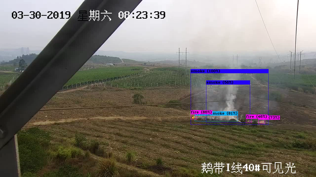
Intelligent algorithm: support visible light/thermal imaging video for target detection and automatic tracking of low-altitude aircraft/airborne objects; support to enhance the accuracy of system alarms through target recognition algorithms; support the functions of target intrusion detection and photoelectric follow-up target tracking in the area; Support photoelectric cruise target detection, detection target follow-up tracking, automatic zoom auxiliary recognition, target recognition auxiliary tracking functions;
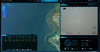
High-definition offline map: Support high-definition offline two-dimensional electronic map, two-dimensional satellite map, three-dimensional satellite map; support photoelectric, radar, spectrum, counter-induction, custom layer area, target point trace, target track and other information Comprehensive situation distribution display based on 2D/3D map; support video pop-up window observation and cloud mirror function scheduling of photoelectric equipment; support map anti-control photoelectric equipment, target track guidance photoelectric observation and sight;
Expanded peripheral access: Supports the access of different manufacturers and different types of equipment such as radar, spectrum, countermeasures, and induction; supports the access of custom standard protocols, and the extended access of new equipment private protocols

Model | RGS1000 Anti-UAV Intelligent Defense Software |
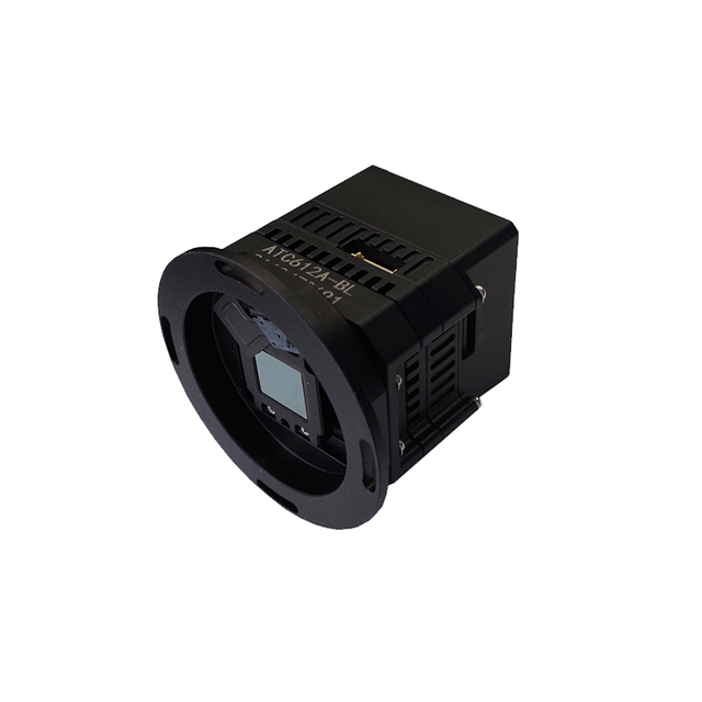
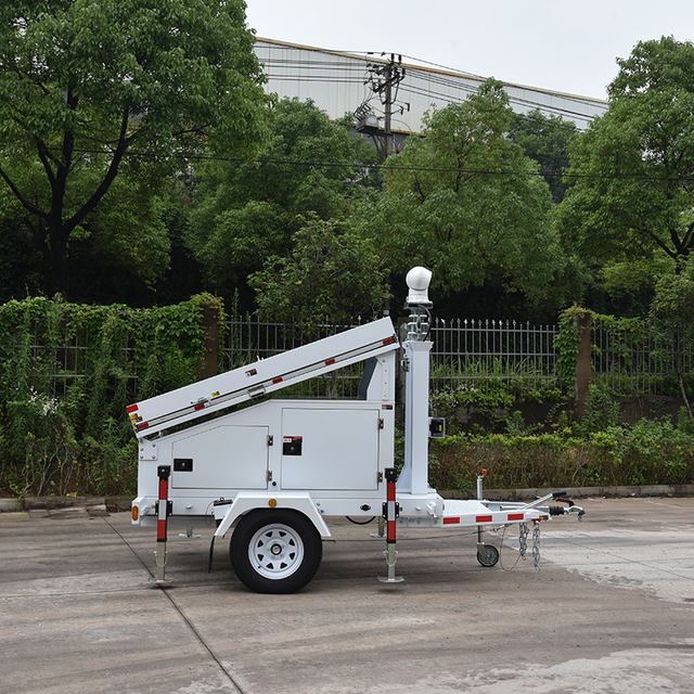
Photoelectric equipment | Tracking photoelectric Electro-Optical/Infra-Red camera |
Detect Defense | 1. Target detection: Support Radar information access, Support spectrum detection; Support dynamic display of UAV target track and track information 2. Target tracking: support radar-guided photoelectric sighting, search, radar-guided photoelectric real-time tracking; support spectrum-guided photoelectric sighting, search, and tracking; support UAV identification and automatic tracking in photoelectric cruise state; support visible light tracking, Thermal imaging tracking, automatic zooming of visible light, automatic zooming of thermal imaging; support automatic zooming of light TV field during tracking 3. Target recognition: support the algorithm identification of drones in the process of photoelectric tracking; support the automatic transfer of drone detection to photoelectric tracking in the process of photoelectric scanning 4. Target disposal: support to counteract and induce by use of UAV counter China Factorys; support to stop, strike and induce UAV targets; support simultaneous strikes in multiple frequency bands and fast strikes in a fixed direction 5. Support radar and spectrum detection target data fusion display 6. Unattended: support unattended mode in the warning zone mode, according to the warning zone plan to alert, track, identify, obtain evidence, and attack the UAV target; support the unattended mode in the photoelectric cruise state, realize the Photoelectric discovery, algorithm identification, automatic tracking, forensic recording and alarm reporting of UAVs; unattended mode that supports lightning guidance, and the photoelectric turntable is automatically controlled by the guidance instructions issued by the radar software to guide sighting, tracking follow-up and target report 7. Multi-level alert: support 4-level early warning zoning; support 7-level threat level analysis; support automatic attack threat level configuration 8. Support aircraft whitelist filtering and control area whitelist filtering 9. Event playback: support the recording, viewing, video playback, and track video synchronization playback of UAV target event information |
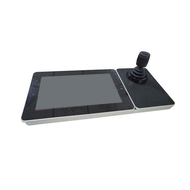
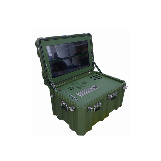
Video Surveillance | 1. Video preview: support single device connection, batch connection, drag and drop connection; support single device disconnection, all disconnection; support automatic reconnection after abnormal video disconnection; support 1/4/6/9/16/25 screen Preview; support multi-screen switch display; support TV mode display; support quick operation of video window function buttons and menu operation; support manual video recording, manual capture 2. PTZ control: support eight-direction PTZ control; support zoom, focus, aperture lens control; support horizontal angle positioning, pitch angle positioning, field of view angle positioning; support 3D click positioning, frame selection, zoom in and out of photoelectric devices position 3. Preset & cruise: support hardware preset, software preset, preset watch; support fan scan, line scan, hardware preset cruise, software preset cruise detection; support setting automatic cruise plan 4. Remote configuration: support remote power on/off, restart, cooling thermal image on/off, image stabilization adjustment, and remote setting of camera parameters for optoelectronic devices 5. Information overlay: support the overlay of real-time orientation information, lens field of view information, bandwidth flow information, weather information, preset name; support overlay display algorithm identification of drones, airborne objects and other target information; support alarm recording , Alarm snapshot overlay target's azimuth information, identification information, pitch information, latitude and longitude information 6. Status monitoring: support real-time monitoring of the connection status and fault status of optoelectronic equipment; support monitoring of horizontal azimuth, pitch azimuth and field of view angle 7. Video playback: support local video playback, alarm video playback, disk array video playback, NVR, IPC device video playback; support fast forward, slow playback, single frame playback and other playback operations; support video summary playback |
Intelligent Algorithm | 1. UAV identification: support visible light, thermal imaging video for multi-rotor, fixed-wing target detection; support to improve the accuracy of the alarm by the target identification algorithm of the UAV 2. Airborne Object Recognition: Support visible light, thermal imaging video to detect airborne objects such as balloons, kites, etc.; support target recognition algorithm through airborne objects to improve the accuracy of alarms 3. Video summary (optional): support the extraction of video summary of alarm recording; support the recording of target summary information such as drones and airborne objects 4. Support the technology of reversely calculating the distance of UAVs by relying on photoelectric tracking without the use of radar, spectrum, and rangefinders 5. Regional intrusion alarm: support intrusion alarm, cross-border alarm; support intrusion target type analysis based on classification algorithm |
Map Situation | 1. 2D map: support offline high-definition 2D map; support switching between electronic map, Google satellite map, sky map, and vector map; support map distance measurement, area measurement, drawing of point, line and surface layer; support map dragging , zoom in and zoom out operations; support scale, eagle eye view; support offline map dragging range limitation; support administrative boundary highlighting; support map display in different background color modes 2. 3D map (optional): support 3D rendering display of satellite maps; support the transition switching function of local 3D maps in 2D maps; support 3D projection effect display under functions such as distance measurement, area measurement, point, line and surface drawing 3. Situation distribution: support photoelectric equipment, radar equipment, spectrum equipment, countermeasure equipment, custom layer area, target point track, target track and other information based on the comprehensive situation of 2D/3D map (optional) Distribution display; support photoelectric equipment video pop-up window observation and cloud mirror function scheduling; support map anti-control photoelectric equipment, target track guidance photoelectric observation and sight |
External Device | 1. Support the access control of hot-sales manufacturers radar; support radar, photoelectric automatic calibration (invention patent) 2. Support access control of multiple spectrum devices 3. Support access control of various countermeasures and inducement devices 4. Support the access of electronic compass, laser ranging and other data |
Interface Protocol | 1. Access protocol: Supports radar and spectrum access of custom standard protocols; supports protocol docking of radar, spectrum, countermeasures, and induction equipment 2. Secondary development: support the reporting and control of target information of custom standard protocols; support secondary development of custom protocols |
※ The system application is related to the protocol and functional characteristics of the camera equipment, the system performance and the hardware resources of the operating environment, please contact us according to the actual situation.